
Earth Graphics Aerial Surveys
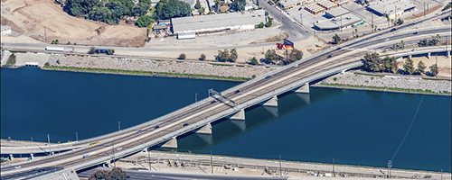
Earth Graphics provides professional aerial mapping and remote sensing services from acquired aerial imagery, airborne lidar, and GPS technologies. We offer state-of-the-art technologies for aerial photogrammetric mapping, geospatial data processing, and related geomatic services to private sectors and governmental agencies.
Earth Graphics has positioned itself at the forefront of the mapping industry by using new technologies and time-tested analysis and quality assurance techniques for our client’s mapping projects.
In order to assure a high quality product, we start by planning our initial survey very carefully. If we don’t have access to prior aerial survey data, we brief our flight crews prior to the start of the project and determine the best environmental conditions for the aerial photography. This includes angle of light, weather, altitude, timing, and more. We also use professional grade imaging equipment such as large format cameras and top-of-the-line lidar units. We believe that it is better to collect high quality input data to begin with than to rely on our engineers to patch things up with software later.
After we collect imagery and remote sensing data, we then process it using a combination of software and expert analysis. This geospatial data processing method allows us to turn raw data into an accurate output product in an efficient manner. We are experienced in topographic and planimetric maps, digital terrain models, parcel mapping, and many other solutions.
We have worked with clients in many industries and governmental agencies, such as land development, energy/utility, mining, and forestry. Our friendly customer service has also earned us a good reputation in the Southern California area, where we are one of the few aerial mapping firms that assures total compliance with California state regulations.
Please feel free to contact us to discuss your mapping needs. We would love to hear from you and we hope to become part of your team.